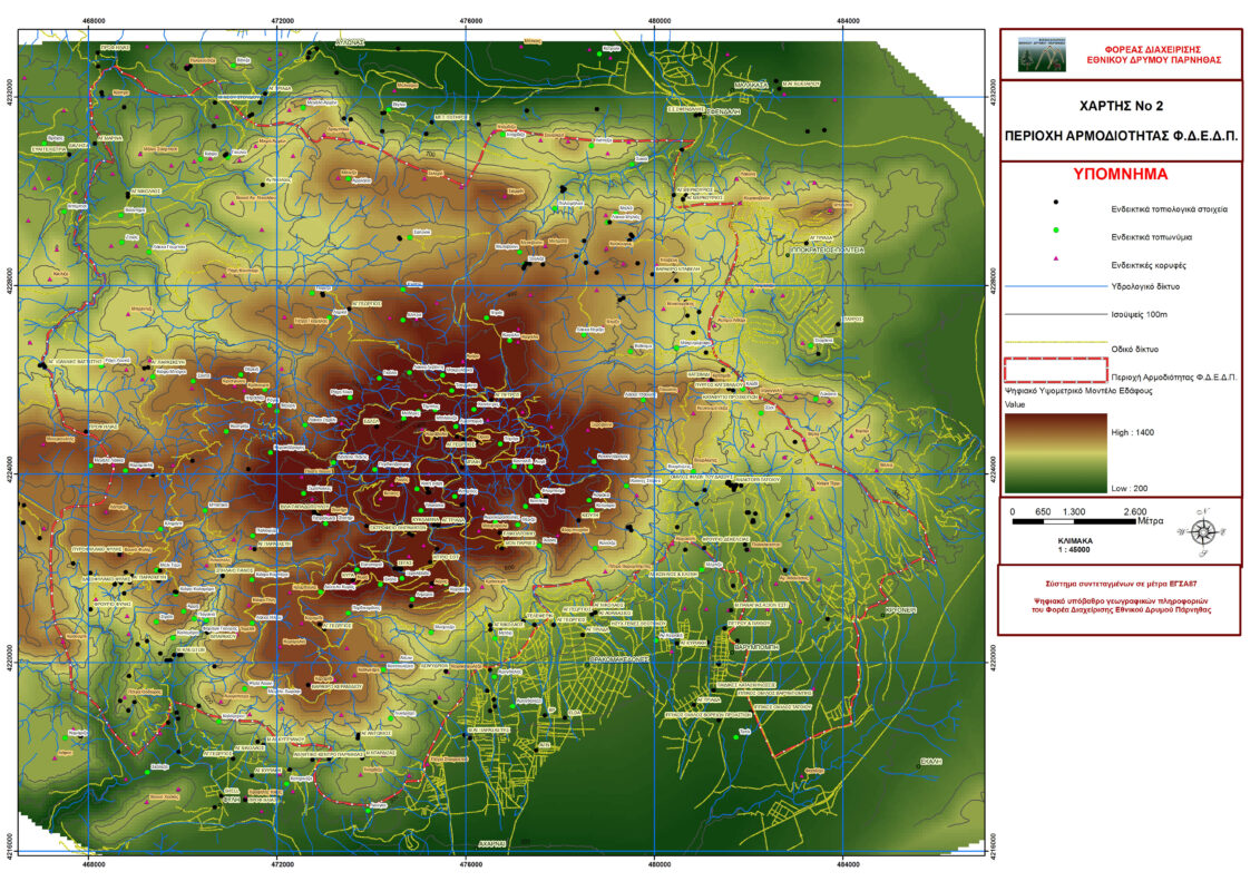
The area of responsibility of the Management Body of Parnitha National Park as defined in Law 3044/2002 is part of the Parnitha Mountains and covers an area of 180,000 acres. Descriptively, the boundaries of the area of responsibility are defined as follows: From the Cable Car to the southern part of Parnitha, the border line is directed NE, bypassing the Community of Thrakomakedones and the Community of Varybombi to Karaouli. Continues south to the southern edge of the former Royal Estate of Tatoi, continues NE and then north along the Community of Kryoneri, passes Vigla and the peak Katsimidi, continues north, bypassing the Hippocratic State, to Agios Mercourios a little further north to the west passing through Dardiza and the top of Skliros. When it reaches the Castle, it descends south to Agia Marina, passes through the east and re-enters the same path to the south, including the mountain of the Tribe. It reaches a little below the top Petra Theodoras and continues N and NE, without including the Tribe. At the Parnitha Sports Center, it continues a little south and follows a north direction, closing the borders of the Parnitha National Park Management Agency in the Cable Car.
The boundaries are shown on the maps of the area.


